Myter og sagn er en viktig del av menneskers nasjonalfølelse og identitet, og de fleste byer og bygder i Norge har sine lokale historier som videreføres til neste generasjon. I et fjell- og skogrikt land som Norge har vi opp igjennom historien delt myten om huldre og troll, men i dagens samfunn vil de fleste av oss omtale dette som eventyrfigurer – først og fremst kjent fra nordisk litteratur. Likevel ser man i dag gjerne troll på norske souvenir-artikler i form av figurer og bilder.
Andre eksempler på skikkelser fra folketroen er alver, feer, yetier, drager, enhjørninger, sjøuhyrer og sjøormer.
Hva er egentlig en sjøorm?
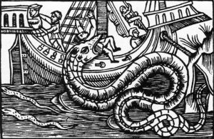
Sjøormer er et stort og slangelignende uhyre som oppholder seg i havet eller i innsjøer. Vesenet er gjerne 10 – 12 meter lang, sort eller grå og glinsende. Enkelte forteller imidlertid at de har sett sjøormer opp til hele 30 – 40 meter. Folk som har observert sjøormer, beskriver ofte at de har hoder som ligner på krokodiller, hester eller elg.
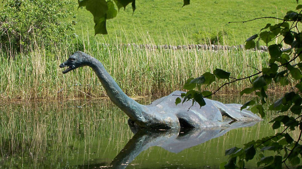
Det aller mest omtalte er sjøuhyret “Nessie”, som skal holde til i innsjøen Loch Ness i Skottland. Forestillinger om sjøorm er en av de mest seiglivede i folketroen, og har en viss utbredelse den dag i dag.
Kryptozoologi
![]() Sjøormer faller innenfor kategorien kryptozoologi – det vil si læren om mytologiske dyr eller vesener som man tror lever i dag eller har eksistert tidligere. Kryptozoologi kjennetegnes videre ved at det foreligger lite eller ingen vitenskapelig bevis for at disse dyrene eller vesenene eksisterer. Likevel kan troen på at de finnes være svært sterk.
Sjøormer faller innenfor kategorien kryptozoologi – det vil si læren om mytologiske dyr eller vesener som man tror lever i dag eller har eksistert tidligere. Kryptozoologi kjennetegnes videre ved at det foreligger lite eller ingen vitenskapelig bevis for at disse dyrene eller vesenene eksisterer. Likevel kan troen på at de finnes være svært sterk.
Sjøormer i norske innsjøer
Det har blitt observert sjøormer i over 50 norske innsjøer og tjern, og fenomenet har vært beskrevet helt siden 1500-tallet.
Sjøormen i Seljordsvatnet i Telemark har fått mest oppmerksomhet i media, og stedet har blitt en populær turistattraksjon. Stadig flere fastboende og tilreisende forteller at de har observert merkelige bevegelser på vannet, og beretningene blir som regel rapportert på solrike og varme sommerdager. Sjøormen i Seljordsvannet har i den nyere tid fått navnet “Selma”. Ved Seljordsvatnet ble det i 2011 oppført et 17 meter høyt observasjonstårn (“Sjøormtårnet”) – slik at besøkende kan få overblikk over innsjøen – og speide etter “Selma”.
I Fyresvatnet i Telemark ble sjøormen “Gjevstrollet” sist sett i 1918. Historien forteller at to menn var ute og fisket da uhyret dukket opp. Den ene av mennene skjøt på ormen med rifle.
 Mange kjenner også til Mjøsormen, som har blitt observert i Mjøsa i Hedmark fylke helt siden 1522. Det kommer stadig blir nye observasjonsutsagn om sjøormen i Mjøsa.
I 1969 var to brødre var på fisketur i Hallandsvannet ved Mandal i Vest-Agder. De kom plutselig over en sjøorm, og den ene mannen kastet en stor stein i hodet på vesenet. Brødrene beskrev ormen som lang og svart med rød munn og store, runde øyne. Oppå hodet hadde den følehorn, og neseborene lignet en nyfødt fole.
I Sogn og Fjordane er det blitt observert sjøorm i Hornindalsvatnet, Loenvatnet og Jølstervatnet.
Det har kommet flere nyere observasjoner om sjøorm i Sandnesvatnet i Hamarøy (Nordland) Vesenet skal ha hatt en kropp som minnet om en hvelvet pram, og sjøormens hode lignet en liten hest.
I Åfjordvatnet (Finnmark) vest for Hammerfest ble det i 1977 sett en sjøorm. Det var 4 personer som observerte det merkelige vesenet, og den ble beskrevet som 5 meter lang med flere pukler.
Innsjøen Kørelen på Sotra utenfor Bergen er berømt for sitt sjøuhyre “Kørelatrollet”. Ifølge bygdebøkene ble sjøormen sist sett i 1910. Sogneprest Johan Fritzner Greve (1832 – 1907) skal selv ha blitt jaget av “Kørelatrollet”, og han fortalte også historien om at sjøormen veltet båten til et brudefølge, og deretter slukte alle menneskene.
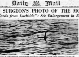 Et fotografi av et sjøuhyre i Loch Ness ble utgitt i 1934. Ifølge historien skulle det være en respektert kirurg som tok bildet. Dette viste seg å være et falskt fotografi, noe som først ble avslørt av avisen London Sunday Telegraph i 1994.
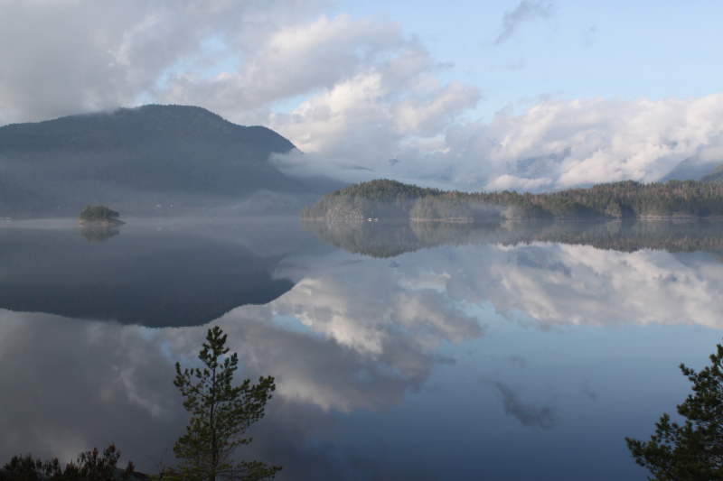
 Romsdalsfjorden ligger i Møre og Romsdal fylke, og en rekke personer har opp gjennom historien observert sjøorm her. En sommerdag i 1815 var 4 menn på fisketur, da de plutselig oppdaget et stort havdyr. Den beveget seg langsomt, buktet seg som en orm, og hadde 10 finner på forparten nær hodet.
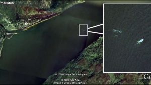 I Østfold fylke har det blitt observert sjøorm på Hvaler i 1902. Sogneprest Hans Davidsen seilte sammen med 6 andre voksne da de fikk øye på sjødyret. Den ble beskrevet som “et ukjent havdyr med tre mørke og glinsende pukler”. Skapningen var 15 – 20 meter lang og hadde et hode som svingte fra side til side. Sognepresten noterte hendelsen i sogneboka for Hvaler, og la ved en skisse av sjøormen.
 En spesiell og svært konkret anekdote i en skriftlig rapport fra 1522, gjengitt i «Hamarkrøniken», fortelles det at en sjøorm ble skutt med stålbue av en av biskopens modige svenner, og at det gikk med flere hundre vedlass for å få brent kadaveret opp etter at det hadde begynt å råtne. Uhyret skulle ha strandet på en klippe på Helgøya, og grønn væske som tøt ut av kroppen skulle ha farget vannet helt inn til Domkirkeodden ved Hamar. Det skal imidlertid ha blitt observert mer enn én sjøorm i Mjøsa i 1522.
 I 2015 – da det var 200 år siden den første kjente sjøormobservasjonen i Mjøsa fant sted – tok en gruppe lokale entusiaster initiativet til en egen «Sjøormfestival» ved Mjøsa.